Bend · Redmond · Sisters · Prineville · LaPine
458-600-6028

Drone Program
Builds

Your drone department, whether we run it for you or hand you the keys. We fly and process under your name, or build your team and equipment from the ground up — your call, your timeline.

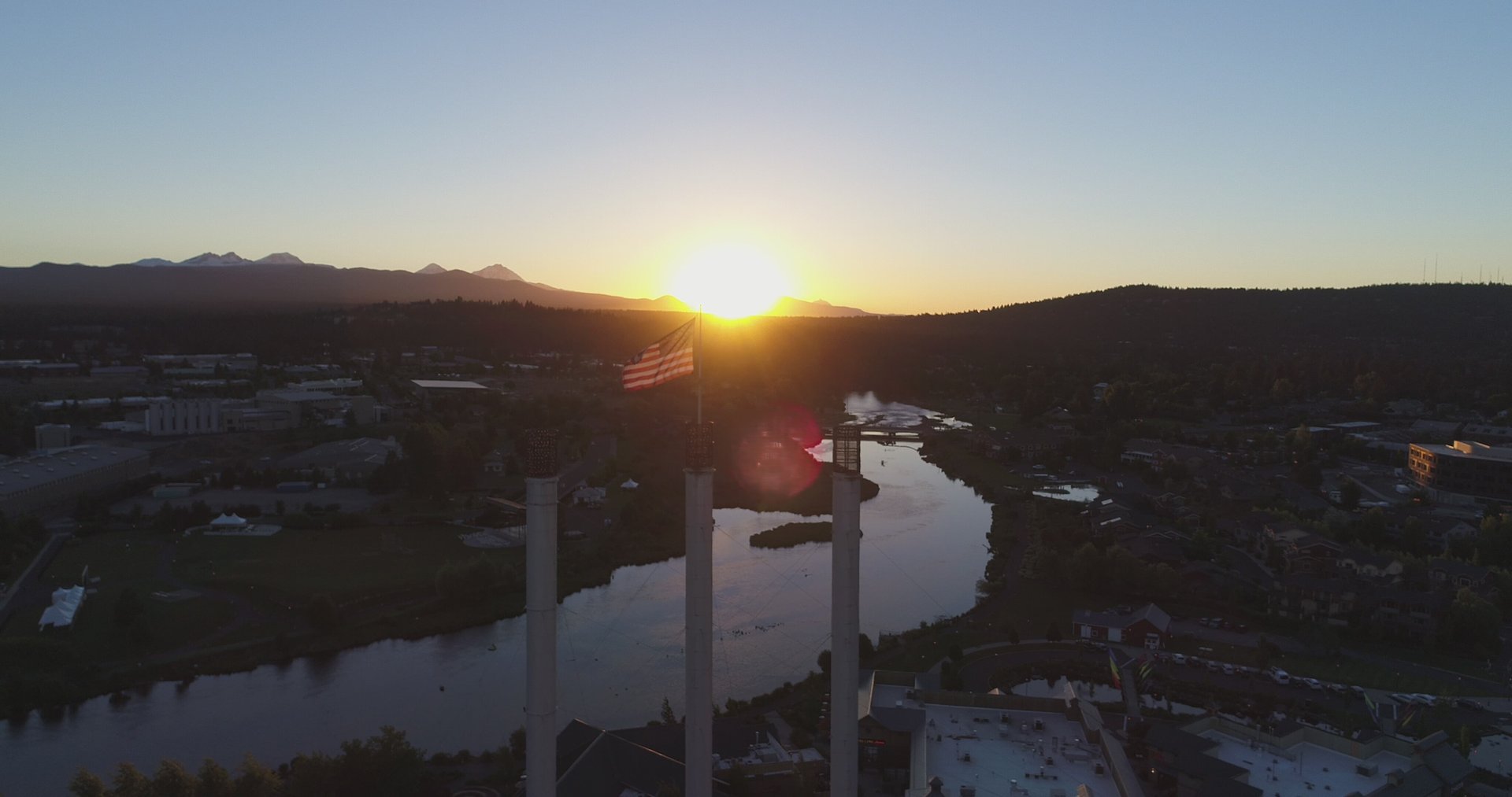
Wide aerial view of Bend with the Old Mill smokestacks, river, and mountains
Branch 04 · Build Your Team

Drone Program Builds

Your drone department, whether we run it for you or hand you the keys.
Option one: we run it for you · Option two: we build your team

Most companies that use drones fall into one of two camps. They either want the capability now without the overhead of owning it, or they want to own it and run it themselves someday. We work both sides of that line, and we'll move you across it on your schedule.

Option one: We're your drone department

We fly, process, and report under your name, for as long as that makes sense. You get the results of an in-house drone program without buying the gear, hiring the pilot, or carrying the insurance. It's a capability on demand.

Option two: We build you one from the ground up

When it becomes clearly more cost effective for you to own the program, we build it for you, piece by piece. We start by running the service on our equipment, then slowly procure yours. We hire your person or people, train them, get them certified, and use them to help build the department as it grows.

  • Gear selection and procurement, matched to your work
  • Pilot training, Part 107 prep, and certification
  • Department structure, standard operating procedures, and manuals
  • Insurance and compliance set up properly from day one
  • Processes for mapping, inspection, and reporting
  • A staged handoff to your team, fully trained and certified

The end state is a department that can stand on its own, run by people we trained, with procedures that survive staff changes. Some companies stay on option one forever because it works. Others take the keys. Both are fine by us.

How the build works

We start by understanding what you actually need the drones to do — mapping, inspection, time-lapse, something else — because the gear and the SOPs follow from that. A company that needs weekly stockpile volumes has a different program than one that needs occasional roof inspections. We set the scope together, then move in order: gear, pilot, procedures, insurance, then the handoff cadence.

The handoff

A handoff is not a one-day event. It is a period where we run the work and your person shadows it, then takes a shift, then runs it with us watching. The SOPs are written as we go, not assembled at the end. By the time we leave, the department is doing what it is supposed to do without us.

Build Your Program →

How It Works

A simple pipeline, done the same way every time.

01 / CAPTURE

We Fly Your Site

A single flight or a recurring pass, on a schedule that fits the job. Mechanical-shutter drone, proper overlap, full coverage — no gaps, no guesswork.

02 / PROCESS

We Build The Map

Hundreds of photos stitch into one georeferenced orthomosaic and measurable model, processed locally with fast turnaround.

03 / DELIVER

You Get The Numbers

Volumes, progress, condition, or time-lapse — in a form your clients, owners, and lenders can actually act on.

The Maps

Orthomosaics: one measurable image of your whole site, stitched from hundreds of individual photos.

Wide aerial view of Bend with the Old Mill smokestacks, river, and mountains
Click to enlarge, then scroll to zoom · Bend aerial

What an orthomosaic is

An orthomosaic is hundreds of overlapping photos stitched into one flat, top-down image of your site. Because every pixel is locked to a real-world position, you can measure distances, areas, and volumes directly on it, no matter how big the site.

It is the base layer behind every volume we report and every progress map we hand over. The same electronic flight path is used for each mission, and so one flight lines up cleanly with the next, and the differences you see over time are real changes on the ground.

Every map we deliver is consistent: the same point lands in the same place on every flight, so a measurement this week matches one next week. If you need survey-grade precision, that is also available, but accuracy does not depend on such precision for most needs. For tracking volume, proving progress, and documenting the job, the consistency we deliver today is the accurate answer.

Why Work With Us

We are Part 107 certified with fifteen years in IT and a background in building and running systems. That combination matters: when we fly your site, the data is processed, measured, and handed over in a form you can actually use, not just a pretty picture.

Everything is flown and processed locally in Central Oregon. Your site, your data, your numbers, no outsourcing and no mystery.

  • Part 107 certified, insured, and professional
  • Mechanical-shutter drone for sharp, distortion-free images
  • Local processing with fast turnaround
  • Built for contractors: you get numbers, not just pictures

The Numbers

15+
Years in Tech & Systems
100%
Local Flights & Processing
24h
Typical Turnaround

Ready To See The Big Picture?

Tell us about your site or your company. We'll tell you what a flight can give you, or what building a program in-house would take. No pressure and no jargon.

458-600-6028
info@oraerial.com
Bend · Redmond · Sisters · Prineville · LaPine