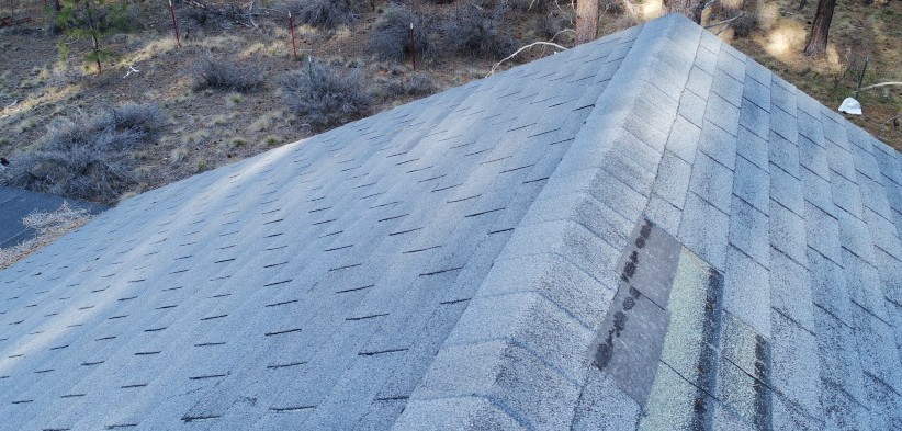
Exterior condition in detail, without a ladder. We capture the roof, the gutters, the penetrations, and the whole building from the air, giving you the full picture fast, safely, and without disturbing the site.

A roof, a building, or a property you need to size up without climbing on top of it. We capture the exterior in detail from the air, giving you the full picture fast, safely, and without disturbing the site.
This is the service for when access is hard, the stakes are high, or both. Insurance claims, buyer due diligence, contractor dispute, post-storm check — any of those sends people up on roofs that may not be safe to walk. We stay in the air.
The deliverable is a set of high-resolution photos organized by face and by detail — the ridge, the flashing around a chimney, the gutter line, the valley, any damaged or suspect area. If there is a claim involved, the photos are there to support it. If it is a buyer checking the condition before they close, the report is there to inform the decision.
We fly the property at an altitude that gives us usable detail on the roof surface and the exterior walls. We do not need to land on the roof or put a person up there — the drone gets close enough to read the condition, and we capture the shots that matter. You get the images plus a summary of what we saw and where to find it in the set.
Request An Inspection →A simple pipeline, done the same way every time.
A single flight or a recurring pass, on a schedule that fits the job. Mechanical-shutter drone, proper overlap, full coverage — no gaps, no guesswork.
Hundreds of photos stitch into one georeferenced orthomosaic and measurable model, processed locally with fast turnaround.
Volumes, progress, condition, or time-lapse — in a form your clients, owners, and lenders can actually act on.
Orthomosaics: one measurable image of your whole site, stitched from hundreds of individual photos.

An orthomosaic is hundreds of overlapping photos stitched into one flat, top-down image of your site. Because every pixel is locked to a real-world position, you can measure distances, areas, and volumes directly on it, no matter how big the site.
It is the base layer behind every volume we report and every progress map we hand over. The same electronic flight path is used for each mission, and so one flight lines up cleanly with the next, and the differences you see over time are real changes on the ground.
Every map we deliver is consistent: the same point lands in the same place on every flight, so a measurement this week matches one next week. If you need survey-grade precision, that is also available, but accuracy does not depend on such precision for most needs. For tracking volume, proving progress, and documenting the job, the consistency we deliver today is the accurate answer.
We are Part 107 certified with fifteen years in IT and a background in building and running systems. That combination matters: when we fly your site, the data is processed, measured, and handed over in a form you can actually use, not just a pretty picture.
Everything is flown and processed locally in Central Oregon. Your site, your data, your numbers, no outsourcing and no mystery.
Tell us about your site or your company. We'll tell you what a flight can give you, or what building a program in-house would take. No pressure and no jargon.